


Showing posts with label karabuk. Show all posts
Showing posts with label karabuk. Show all posts
Saturday, November 1, 2014


Tuesday, October 7, 2014
The House of the Sub-Governor (Turkish: Kaymakamlar Evi) is located in the Safranbolu district of Karabük Province. The house was built in the first years of 19th century.
Kaymakamlar Evi
Coordinates: 41° 14' 40.25" N 32° 41' 39.65" E
 |
| Photo by omeronut |
 |
| Photo by omeronut |
 |
| Photo by omeronut |
 |
| Photo by omeronut |
Kaymakamlar Evi
Safranbolu Clock Tower (Turkish: Safranbolu Saat Kulesi) is located in the Safranbolu district of Karabük Province. The tower was ordered Grand Vizier İzzet Mehmet Pasha built in 1797.
Coordinates: 41° 14' 45.45" N 32° 41' 26.75" E
 |
| Photo by omeronut |
 |
| Photo by Tacettin KAYA |
 |
| Photo by Engin BIYIKOĞLU |
Safranbolu Museum (Turkish: Safranbolu Müzesi) is located in the Safranbolu district of Karabük Province. The museum was opened in 2006.
Coordinates: 41° 14' 44.17" N 32° 41' 26.13" E
 |
| Photo by ahmet zeki yavaş |
 |
| Photo by Kayıhan Bölükbaşı |
 |
| Photo by Azize P. |
 |
| Photo by omeronut |
Cinci Hammam (Turkish: Cinci Hamamı) is located in the Safranbolu district of Karabük Province. The hammam was ordered by Cinci Hoca and was built in 1645 by Koca Mimar Kasım Ağa.
Coordinates: 41° 14' 40.14" N 32° 41' 36.64" E
Coordinates: 41° 14' 40.14" N 32° 41' 36.64" E
 |
| Photo by Nurettin Peşkircioğlu |
Cinci Han (Turkish: Cinci Hanı) is located in the Safranbolu district of Karabük Province. The han was built in 1645 by the order of Cinci Hoca (Kazasker Hüseyin Efendi).
Cinci Han
Coordinates: 41° 14' 40.29" N 32° 41' 36.52" E
 |
| Photo by Ahmet SERTTÜRK - EKSEN BALDO PİRİNÇ |
 |
| Photo by inan killi |
 |
| Photo by inan killi |
 |
| Photo by inan killi |
Cinci Han
Friday, September 12, 2014
Bulak Mencilis Cave (Turkish: Bulak Mencilis Mağarası) is located in the Karabük Province. The cave was formed about 200 million years ago. There is a stream in the cave. The cave is 5250 m long.
Coordinates: 41° 16' 35.75" N 32° 37' 35.86" E
 |
| Photo by FARUK ÖNCÜ |
 |
| Photo by seiko_5 |
 |
| Photo by Azize P |
 |
| Photo by Azize P |
 |
| Photo by ali çabuk |
 |
| Photo by seiko_5 |
 |
| Photo by ali çabuk |
 |
| Photo by FARUK ÖNCÜ |
Saturday, August 9, 2014
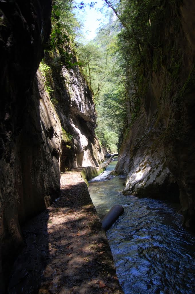
Şeker Canyon (Turkish: Şeker Kanyonu) is located in the Yenice district of Karabük Province. The canyon is 6,5 km long.
Coordinates: 41° 9' 18.25" N 32° 21' 38.83" E
Seker kanyonu yenice genel gorunum
Coordinates: 41° 9' 18.25" N 32° 21' 38.83" E
 |
| Photo by Kadir Korkmaz |
 |
| Photo by mehmetgokhansoydan |
 |
| Photo by mehmetgokhansoydan |
 |
| Photo by canon a 560 |
 |
| Photo by Ahmet G. M. |
 |
| Photo by mehmetgokhansoydan |
 |
| Photo by Kadir Korkmaz |
 |
| Photo by Kadir Korkmaz |
Seker kanyonu yenice genel gorunum
Uluyayla is a yayla located in the Eflani district of Karabük Province.
Coordinates: 41° 32' 22.38" N 32° 48' 5.66" E
Uluyayla - Kirlangic Magarasi
Coordinates: 41° 32' 22.38" N 32° 48' 5.66" E
 |
| Photo by arcturus |
 |
| Photo by keramettiin şenkal |
 |
| Photo by arcturus |
 |
| Photo by eagleee |
 |
| Photo by keramettiin şenkal |
 |
| Photo by abuzelll |
Uluyayla - Kirlangic Magarasi
Wednesday, July 30, 2014
İncekaya Aqueduct (Turkish: İncekaya Su Kemeri) is located in Safranbolu district of Karabük Province. The aqueduct was built ib 18th century by İzzet Mehmet Pasha. It is 116 m long and it has 6 arches.
Coordinates: 41° 16' 55.43" N 32° 41' 5.89" E
Coordinates: 41° 16' 55.43" N 32° 41' 5.89" E
 |
| Photo by Ahmet SERTTÜRK - EKSEN BALDO PİRİNÇ |
 |
| Photo by Kenan HAZAR |
 |
| Photo by mustafa can |
 |
| Photo by köfteci enişte |
Wednesday, July 2, 2014
Safranbolu is a district of Karabük Province in the Black Sea region of Turkey. Safranbolu is in the UNESCO World Heritage Site.
Coordinates: 41° 14' 37.00" N 32° 41' 36.33" E
Safranbolu - Snowdrop Mansion - Overview
Coordinates: 41° 14' 37.00" N 32° 41' 36.33" E
 |
| Photo by Cemil özkan |
 |
| Photo by nedime |
 |
| Photo by Ahmet poçanoğlu |
 |
| Photo by Nurettin Peşkircioğlu |
 |
| Photo by köfteci enişte |


