Monday, June 30, 2014

Yuksekova

Yüksekova is a plain and a district of Hakkari Province of Turkey. 

Coordinates: 37° 26' 33.72" N  44° 23' 57.69" E

Photo by Sharaj Bahrah

Photo by Tahir Yılmaz
Photo by Tahir Yilmaz

Photo by Can Med

Photo by SHARAJ BAHRAH

Halfeti Ulucami

Halfeti is a small distrcit on the east bank of the river Euphrates (Fırat) in Şanlıurfa Provenice in Turkey. Most of the villages were submerged in the 1990s under the waters behind the damn on the Euphrates at Birecik. 

Coordinates: 37° 14' 46.22" N  37° 51' 59.45" E

Photo by H. İbrahim Üzmezoğlu

Photo by MESUT KAÇAR

© http://mekan360.com/

Harran Houses

Harran was a major ancient city in Upper Mesopotamia whose site is near the modern village of AltınbaşakTurkey, 44 km southeast of Şanlıurfa.

The earliest records of Harran come from Ebla tablets (3rd millennium BC). 

Coordinates: 36° 51' 41.87" N  39° 1' 59.95" E

Photo by H. İbrahim Üzmezoğlu

Photo by inan killi
Photo by H.İbrahim Üzmezoğlu

Photo by Metin Erinc

Photo by gezgin Rose


Kapuzbasi Waterfall

Kapuzbaşı Waterfall (Turkish: Kapuzbaşı Şelalesi) is a waterfall which is located in the Kozan district Adana ProvinceThere are two waterfalls in the area. The bigger waterfall is about 20 meters high and smaller waterfall is about 10 meters high.

Coordinates: 37° 46' 18.48" N  35° 23' 32.22" E

Photo by mustafator

Photo by ahmet ersungur

Mount Demirkazik

Demirkazık, is a 3756 meters high mountain which is located in Aladağlar area, in Niğde. Demirkazık was known the highest point of Aladağlar but now, it's known that, the highest point of Aladağlar is Kızılkaya. 

Coordinates:  37° 43' 56.70" N  35° 4' 52.26" E

Photo by mustafator

Photo by www.turclubmai.ru


Lake Yarisli

Lake Yarışlı (Turkish: Yarışlı Gölü) is located in BurdurYesilova. The lake is located between HarmanlıYarışlıSazakKocapınar and Düğer villages.

Tymbrianassus ancient city is located the east of lake.

Coordinates: 37° 35' 6.36" N  29° 59' 14.71" E


Photo by Refik Yavaş

Photo by kentavras


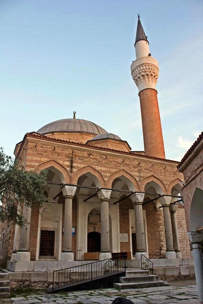
Pasa Mosque

Paşa Mosque (Turkish: Paşa Camii) is located in the Tire district of Izmir Province. The mosque was built in 1500s.

Coordinates: 38° 5' 17.01" N  27° 44' 1.99" E

Photo by Ercan Baysal

Photo by ismail bjk

Kalamis

Kalamış is a district which placed Istanbul's Anatolian side. It's between KurbağalıdereKızıltoprakFeneryolu and Fenerbahçe. There is a large marina and a large park in Kalamış. Some night clubs and resturants are also nearby.

Coordinates: 40° 58' 37.63" N  29° 2' 21.17" E

Photo by Mehmet Güçlü
Photo by Cemil Özkan

Lake Manyas

Manyas Kuşgölü (Lake Kuş - Bird Lake) is a lake in western Turkey, located in Bandırma Region.

Manyas Kuşgölü is a shallow freshwater lake fed by streams and groundwater.

Manyas Lake is an important site for breedin and wintering waterbirds. More than 270 species of birds have been recorded at the lake.

Coordinates: 40° 13' 55.06" N  28° 2' 24.23" E

Photo by Nuri Erzaim


Photo by Nuri Erzaim


Buyukada

Büyükada (Big Island) is the largest island of Prince Islands, in Sea of Marmara, near Istanbul. The island is about 2 square miles.

Byzantine Emperor Justin II had built a palace and a monastery on Büyükada in C.E. 569.

There are several historical buildings on Büyükada, such as Agia Yorgi Churchthe Agios Dimitrios Church, the Hamidiye Mosque.

Today, the population of Büyükada is about 7.000 people.

Coordinates: 40°51′28″N 29°07′12″E

Photo by Mehmet Güçlü

Photo by köfteci enişte